Echoes in the Sand: A Detectorist’s Guide to Whitby Beach
Every time the North Sea tide recedes from the shores of Whitby, it leaves behind more than just wet sand and seaweed. It exposes fragments of a rich history that spans from ancient Celtic saints and Viking raiders to Victorian holidaymakers and tragic maritime disasters. For those who know how to listen to the modern hum of a metal detector, Whitby Beach is a graveyard of lost things waiting to be found.
The Layers of Whitby’s History
To understand what might be hiding under the sand, you have to look up at the cliffs. The history of Whitby is deeply layered, and every era has left a footprint on the shoreline below:
The Anglo-Saxon & Viking Age (657–867 AD): Long before the current stone ruins, St. Hilda founded the first monastery on the cliffs in 657 AD. It was a thriving cultural hub until 867 AD, when Viking raiders smashed it to pieces. Centuries of cliff erosion mean that early medieval items—from Anglo-Saxon stycas (small bronze coins) to Norse strap-ends—have slowly tumbled into the sea and onto the beaches below.
The Age of Sail and Smuggling: By the 18th century, Whitby was a powerhouse of shipbuilding and whaling (it’s where Captain James Cook’s famous ship, the HMS Endeavour, was built). The harbor was packed with sailors, merchants, and smugglers slipping contraband through the rocky gaps.
The Victorian Boom: When the railways arrived in the 1800s, Whitby became a premier resort town. Thousands of wealthy Victorians flocked to the beaches to take in the sea air. They brought with them pocket watches, loose change, and intricate jewelry, much of which slipped silently into the dry sand during a dip in the surf.
The Dracula Connection: In 1890, Bram Stoker stayed on Whitby’s West Cliff and found inspiration for Dracula. In the novel, the vampire’s ship, the Demeter, runs aground on Whitby beach during a terrifying storm. This isn’t pure fiction; Stoker based the event on real, frequent shipwrecks that plagued this notoriously dangerous coastline.
Where to Focus Your Search
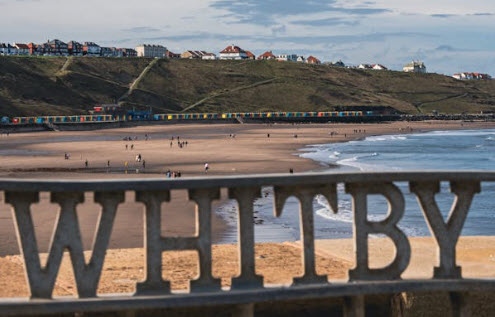
Whitby is split into two distinct beach areas by the River Esk, and each offers a very different detecting experience.
1. The West Cliff Beach (The Resort Sands)
This is the long, sandy stretch that runs toward Sandsend. It is the prime spot for finding modern “clist” (spendable modern coins) and lost jewelry, but don’t overlook its historical potential.
The Towing Line: Target the areas near the slipways and the base of the sea walls where Victorian holidaymakers gathered.
Storm Gullies: Look for “scallops” or gullies carved out by heavy surf. When the top layers of sand are stripped away, you are left with a natural stony floor where heavy metallic objects—like old pennies and silver rings—settle.
2. The Tate Hill & East Cliff Beaches (The History Hotspots)
Tate Hill beach sits just inside the harbor mouth, right below the 199 steps leading to the Abbey.
The Catchment Zone: Because this beach sits in the shadow of the old town and the Abbey cliff, it is a prime catchment zone for truly ancient items washed down by the river or eroded from the cliffs.
What to expect: You are far more likely to find heavily corroded copper tokens, old ship nails, musket balls, or ironwork from forgotten shipwrecks here.
The “Other” Treasure: Whitby Jet
While you are swinging your detector, keep your eyes peeled for Whitby’s famous non-metallic treasure: Whitby Jet.
Formed from the fossilized wood of the ancient Araucaria (Monkey Puzzle) tree under immense pressure, this deep-black gemstone became a massive industry in the Victorian era, heavily popularized by Queen Victoria’s mourning jewelry. While your detector won’t beep for it, the gemstone is frequently turned over by the tides. Look for lightweight, matte-black “pebbles” caught in the seaweed lines. If it feels warm against your cheek (unlike cold sea glass) and leaves a brown streak when rubbed on unglazed porcelain, you’ve found genuine jet.
Technical Tips for Success on the Yorkshire Coast
Beach detecting comes with its own unique set of challenges. To maximize your chances of success, keep these strategies in mind:
Tackle the Mineralization: The wet sand at Whitby is highly mineralized due to salt water and black iron-sand deposits. If you are using a standard entry-level single-frequency detector, you will likely get a lot of “chatter” or false signals. For the wet sand, you will need a machine with a dedicated beach mode or a multi-frequency detector to balance out the salt ground noise.
Work the Tides: The best time to detect is two hours before low tide. This gives you maximum access to the wet sand where the heavy targets hide.
Be Mindful of Safety: Whitby is famous for its towering cliffs, but they are highly unstable. Never detect directly beneath the cliff face—landslips are common. Always keep an eye on the incoming tide, as it can cut you off against the rocks faster than you think.
The Rules of the Sand
Before you switch on your machine, remember the detectorist’s code:
Permissions: The foreshore (the area between high and low tide) at Whitby is generally permissible under the Crown Estate general consent, but always check local council signage for any seasonal restrictions or protected archaeological zones.
Dig Clean: Always fill your holes. Leaving open craters on a popular public beach gives the hobby a bad name and is a safety hazard for beachgoers.
The Treasure Act: If you are lucky enough to dig up something truly spectacular that looks to be over 300 years old or contains precious metal, you are legally required to report it to the local Finds Liaison Officer (FLO) under the UK Treasure Act.
Whether you pack up your pouch at the end of the day with a handful of decimal coins or a beautiful silver piece of Victorian history, detecting at Whitby is as much about the atmosphere as it is about the finds. Happy hunting!